Custom Planimetric Symbols

Understanding Custom Planimetric Symbols


Planimetric symbols refer to the symbols used on maps and plans to denote various features in a plan view (top-down view). These symbols are used to represent real-world features on a flat, two-dimensional plane. Planimetric symbols are important in cartography, land-use planning, architecture, and many other fields where spatial representation is essential.

Standard Symbols from ROCK Planimetrics Layers are as follows:


• CONCRETE BOTTOM
• CONCRETE TOP
• BACK OF CURB
• BOTTOM OF CURB
• FOOT PATH
• PAINT STRIPE
• PAVED DRIVEWAY
• PAVED ROAD
• TOP OF CURB
• GUTTER
• UNPAVED DRIVEWAY
• PAVED PARKING
• CONCRETE
• BUILDING
• GUTTER BOTTOM
• TREELINE
• BRUSHLINE
• FENCE
• DRAINAGE PIT
• UNPAVED ROAD
• RAILS
• ROUND TANK
• BRIDGE
• GUARD RAIL
• TOP OF DRAINAGE
• BOTTOM OF DRAINAGE
• HARD SURFACE
• EDGE OF GRASS
• TOP OF RETAINING WALL
• BOTTOM OF RETAINING WALL
• ABOVE GROUND PIPE
• CULVERT PIPE
• HAND RAIL
• MISCELLANEOUS
• SHRUBLINE
• CATTLE GUARD
• PIPELINE
• ELECTRIC POLE
• FIRE HYDRANT
• LIGHT POLE
• MANHOLE
• MISCE SYMBOL
• SHRUB
• SINGLE TREE
• SIGN BOARD
• TRAFFIC SIGNAL
• RAMP
• DOCK
• AIRPORT RUNWAY
• DAM
• SWIMMING POOL
• TENNIS COURT
• PARKING PAINT STRIPE

Adding Custom Symbols

Select "Custom Symbols" add-on to apply your own symbols to the ROCK Planimetric deliverable.

When ordering ROCK Planimetrics you can add your own custom symbols to the deliverable by doing two things:

1. Download the ROCK Robotic Planimetric Template File:

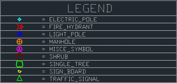
2. Update the template file to include your symbols / colors for the supported layer names.

legend1

If you need additional / different layers, contact [email protected] for a custom quote

3. Upload the customized dwg, dgn, dxf file(s) to your project data before ordering ROCK Planimetrics.

4. Select the "Custom Symbols" add-on when ordering ROCK Planimetrics.

Complete and Continue