Exploring Planimetrics (Linework)
Exploring ROCK Planimetrics (Linework)
Step-by-step guide to ordering ROCK Planimetrics deliverables.
What are ROCK Planimetrics?
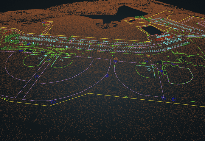
ROCK Planimetrics takes LiDAR data and/or an Orthomosaic and will produce planimetric points, lines, and polygons to digitize your data.
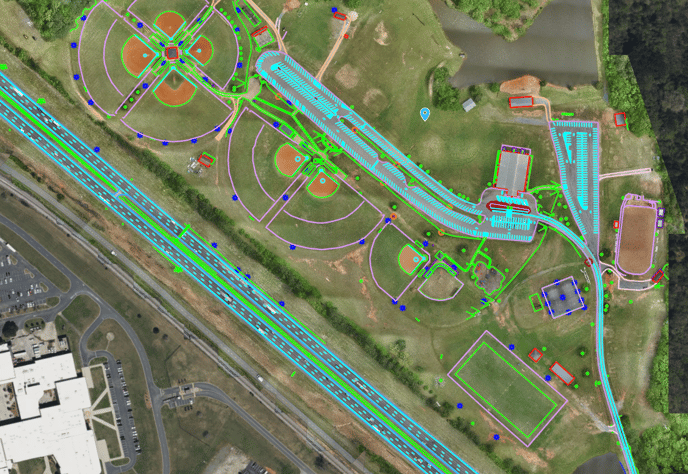
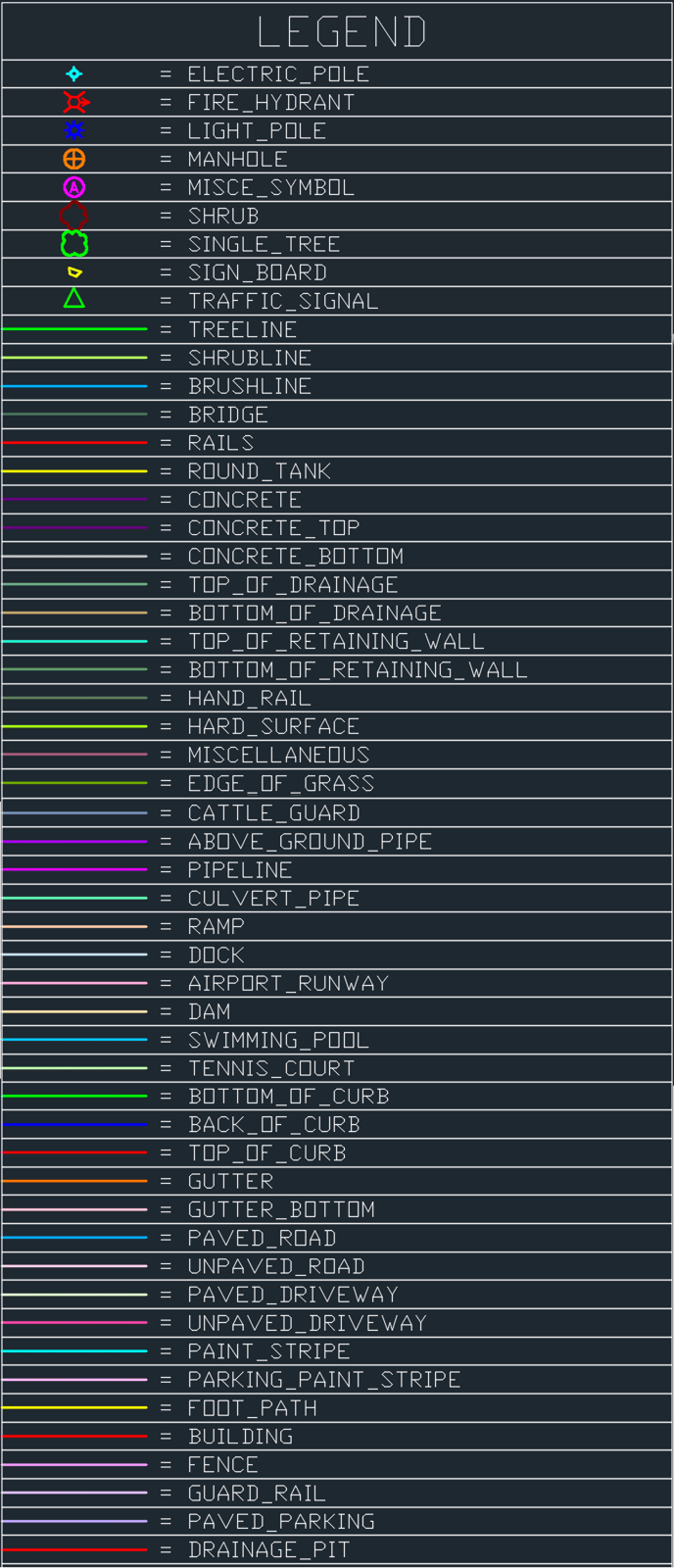
The following assets will be digitized:
Download the ROCK Robotic Planimetric Template File:
- ROCK_Robotic_Planimetrics_Template.dwg
-
ROCK_Robotic_Planimetrics_Template.dgn
- ROCK_Robotic_Planimetrics_Template.dxf
Example Dataset: https://cloud.rockrobotic.com/share/958a84ce-88b9-4162-b287-877c3ac85543
If you need Custom Symbols for the existing supported layers -- Order the "Custom Symbols" add-on.
If you need Custom Layers email support@rockrobotic.com for a custom quote.
How To Order Planimetrics From The ROCK Marketplace
Choosing What to Process
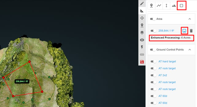
- Prior to ordering the deliverables from the ROCK Cloud, select the area you want processed for your deliverables using the area tool (see picture below). For example, you have a 500 acre forest that has a road running through it. Instead of ordering ROCK Planimetrics for the whole space, select the area of interest with the road to save some tokens!
To process the entire dataset follow the "Placing Your Order" steps below without creating an enhanced area.
- To run a smaller subset area of your dataset create an enhanced area by:
- Use the "measure area" tool in the top right (square icon).
- Draw your area of interest.
- Click the image icon to the left of the trash bin on that measurement to make this measurement and "enhanced area."
Placing Your Order
Be sure you have all the GCP's you want for the dataset upload PRIOR to placing your ROCK Planimetrics order. If you process ROCK Planimetrics and then wish to upload more GCP's you will need to contact ROCK Support for manual processing costs.
- Go the ROCK Marketplace by clicking the green "process" bar in the bottom of the left pane.
- Click "Order" on the ROCK Planimetrics Item.
- Choose whether the dataset contains urban, rural, semi-urban features (this will impact the tokens per acre cost).
- Review your Order Summary for pricing breakdown and the delivery estimate of your order.
Tip: Learn the difference between urban, semi-urban, and rural. This will have an impact on both cost and timeline. Your deliverable may be delayed if an incorrect selection is made.
Tip: Please ensure the acreage being processed meets your expectations. If you need to adjust your enhanced area polygons do so BEFORE you place your order. We are unable to refund tokens used after processing starts. See also: Order ETA
Deliverables
- 3D SHP file
- 3D DWG
- 3D DXF file
If you need to adjust your point cloud after processing has finished (translate, add GCPs, etc) you will need to alert the ROCK Support Team by emailing support@rockrobotic.com so that your planimetric deliverable files can also be corrected.
Example Dataset: https://cloud.rockrobotic.com/share/958a84ce-88b9-4162-b287-877c3ac85543